FAIRLY OR NOT, many Portlanders consider 82nd Avenue a boundary line. A wall between Portland and something else.
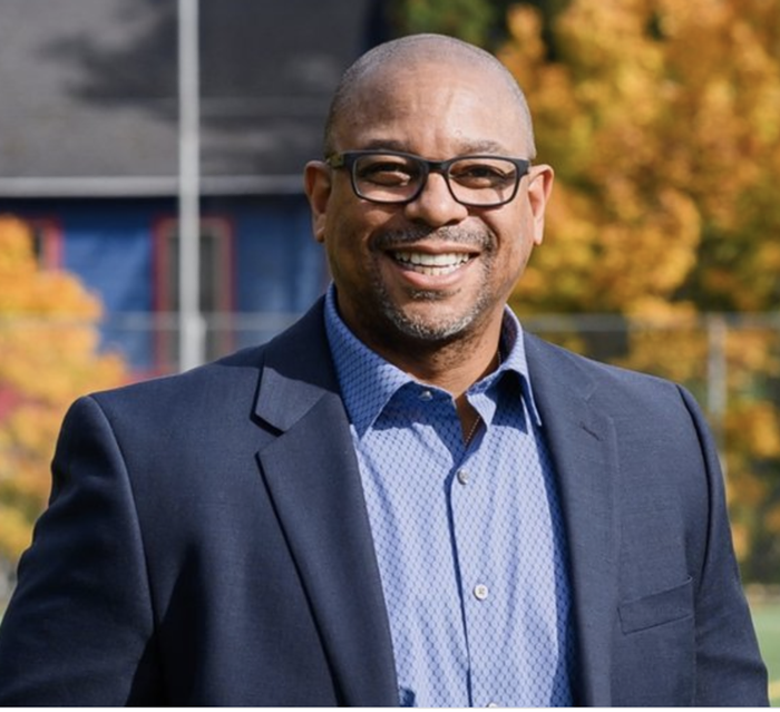
"I have this joke about Portland and East Portland," says Jamaal Green, a Ph.D. student at Portland State University studying urban planning, East Portland in particular. "If you were to make a map of the city, it would look like one of those old Renaissance maps with clouds and dragons. People went [to East Portland] and they never returned! We have no idea what's going on there!"
East Portland, however, is Portland. Depending on how you quantify the area east of 82nd, the region has roughly one-fifth of Portland's land, a quarter of the population with nearly 40 percent of Portland's youth, and the most diverse and rapidly growing sections of the city. And yet, it is all too often casually referred to as a hinterland.
That characterization is implicitly biased about our city's culture and what the demographics are supposed to look like. Since the early 1970s, Portland has made a concerted (and very successful) effort to revitalize the urban core and inner neighborhoods. Downtown, the Pearl District, and Alberta are all former examples of urban blight, the seemingly intractable bugbear of politics and planning for much of the 20th century.
"As we've seen return to the central city," says Erin Goodling, another PSU Ph.D. student who studies the area, "we've seen relative disinvestment and flattening [elsewhere]."
Goodling notes that housing prices, property values, and property taxes have risen considerably in Portland since the urban core has been revived—but not in East Portland. For instance, a side effect of North Mississippi's makeover is that poor and minority populations have migrated to the city's periphery.
Lore Wintergreen is an advocate for the East Portland Action Plan, and she recalls a conversation she had with an African American man who lived in Albina: "He said, 'It's historically appropriate for us to live where you want us to live... I'm moving to outer East Portland, where you want us to live now.' This was in 1999... he needed a larger home, and he knew he would not be able to buy as large a home in North or Northeast."
Displacement and Lack of Representation
Portland has a problem with inclusivity. Unlike every other state in the US except Texas, Oregon lacks inclusionary zoning laws, which benefit low-income and minority populations.
"Inclusionary zoning," says Vivian Satterfield, an advocate with OPAL Environmental Justice Oregon, "is a land-use policy that says that, for either homeownership or rentals, any time a new development is being built a certain percentage of those units have to be set aside for a diversity of options."
Inclusionary zoning was banned in Oregon in 1999, and without it the "invisible hand" of the market determines the costs of housing throughout the state.
According to PSU's Green, that leads to segregation by income levels.
"Part of the reason why East Portland looks the way it does," he explains, "is that people who live [there] may desire to live further into the city and access amenities—but may not be able to do so because of prices. That's how you get segregation. It's relatively benign in our system, because it's [based on] income... but it's something to think about."
Satterfield is blunt about the city's historical neglect of East Portland's population. "[It's] because they're brown and poor," she says. "Racism and classism are real, and when you concentrate poverty, and when you concentrate communities of color, it becomes easy to ignore them."
It doesn't help that East Portland has a lack of direct representation in city government. Portland is a curiosity among American cities, in that the city elects at-large council members, who act more as bureaucratic administrators rather than representatives of districts.
"There is a lot of political organization happening," says Goodling, "but [East Portland's] place in the city is different than if they had an elected official who was answerable to a particular geographic area."
A ballot measure to end Portland's commission form of government failed in 2007, and since the system was adopted over a century ago, only one commissioner, Randy Leonard, has hailed from East Portland.
But the region was not a product of accident. Several factors, from sewers to suburbanization, have shaped Portland's eastern edge.
"There is no one causal thing that you can point at to say, 'This is why East Portland is the way it is,'" says Goodling, "You have to dig into layers of planning and policy."
The region still bears the marks of its suburban and rural origins, and Portland's politics have stacked the deck against it. To understand the area's present, one has to dig into its history.
"Free-Wheeling Developments"
East Portland's layout has very different roots than the rest of the city's. Downtown, the West Hills, Central Eastside, and North Portland are all products of early 20th century urban development; neighborhoods developed along (now long-gone) streetcar routes that bound residential areas to the urban core and adjoining neighborhoods. Walking, mass transit, and easy access to downtown defined inner Portland neighborhoods.
East Portland, though, came into its own during a very different era of American urban development. (A notable exception is Lents, which existed as a well-defined streetcar community since the early 20th century, and was annexed by Portland in 1912.) Suburbs flourished after WWII, and housing started popping up in the unincorporated land on Portland's periphery. This new development grew without the focusing influence of streetcars or urban planning, which had so strongly shaped inner Portland. East Portland was defined by the private automobile, a postwar consumer luxury that supposedly obviated the need for sidewalks and transit.
Planners in what was then called the "mid-county" area could parcel out larger lots and make houses bigger, faster, and cheaper than in Portland proper or other incorporated areas. "You didn't have to adhere to city zoning codes, and there were much less strict infrastructure provisions," says Green, "that's one reason why the EPA [Environmental Protection Agency] encouraged Portland to take over unincorporated Multnomah County. These people were unconnected to sewer."
Rather than being connected to miles of Portland's sewer system, the "free-wheeling developments" (as Green calls them), simply drilled down and created septic tanks for these new stretches of suburban and rural homes. It was a post-WWII trend that would come to define the area and have dramatic consequences decades later.
The City That Never Was
Then there were rumblings of citifying this built-up region between Portland and Gresham. During the 1960s and until the 1980s, various residents, planners, and leaders seriously considered turning the area into a new city all its own. The proposed suburb of Columbia Ridge would've had a population of approximately 125,000, and roughly corresponded to where East Portland is today.
However, Portland annexed about 200 acres of industrial land near what is now NE Airport Way in 1981. The loss of the potential jobs, taxes, and economic activity that the industrial area would have provided was a death blow for Columbia Ridge, and the mid-county area never incorporated.
Not-so-fun fact: According to the Oregonian, Columbia Ridge would have been the largest city in the US at the time without a sewer system.
Annexation
In 1983, the City of Portland passed an urban services policy, which stated that the city would provide services (understood to be mainly water and sewer) to the unincorporated area. Multnomah County, in turn, passed Resolution A. With this ominously named referendum, the county ceased providing services—like elections and libraries—to unincorporated areas. Prior to annexation, Portland was administering and serving the area... even though it didn't "have" the area.
The lack of sewers was probably the biggest issue, though, and the Mid-County Sewer Project quickly followed, and residents east of 82nd soon found themselves paying to be connected to Portland's sewer grid, and not without reason. Septic tanks and cesspools from the postwar period were showing their age, and waste was seeping into the area's groundwater, which in 1984 the county warned couldn't be consumed safely on a reliable basis. According to Green and Goodling, the city faced intense pressure from the EPA and federal government to annex the area and provide the necessary services directly.
By 1994 the entire area was within Portland city limits. Sewers had been gradually installed at a cost of approximately $255 million, according to the Portland Bureau of Environmental Services—much of which was subsidized by residents. East Portland had joined Portland on paper, but still would not be represented in city hall, nor would it be accepted conceptually or culturally by a substantial portion of the (white, middle- and upper-class) population.
"City leaders were disillusioned with county planners and how growth was being controlled," says Goodling. "It was not benefiting Portland's interest. They saw this tension over who was going to provide sewer services in Portland as an opportunity to say, 'Hey, look, this is something we can do.' Dennis Buchanan, a Multnomah County executive at the time, said the annexation would strengthen the city's position ‘in dealing with the state legislature on land-use issues by converting legislators in the mid-county districts into city stakeholders.’"
While East Portland is now Portland proper, its suburban and rural beginnings are still apparent. For example, East Portland has far fewer parks than the rest of the city. The area has nearly 40 percent of Portland's youth population, but only 13 percent of the city's park acreage. Some streets have no sidewalks, and several of the wide lots have been stuffed with housing. Skinny houses wedged between larger units are a common sight, as are flag lots—areas that have a small driveway facing the street (the "pole") that extends out to a wider area behind another structure (the "flag"). Gravel and unimproved roads abound, and East Portland experiences 41 percent of Portland's fatal traffic crashes, according to a report from the city auditor earlier this year.
Since other neighborhoods (most notably Albina) have gentrified, low-income and minority populations have streamed into the formerly rural area. This is not a trend unique to Portland. Cities nationwide are seeing poverty-stricken people pushed outward to suburban and exurban areas. According to the 2010 census, for instance, census tracts 8901 and 9102 (i.e., the Powellhurst-Gilbert area) saw a 330 percent and a 413 percent increase, respectively, in African Americans since 2000. (Meanwhile, the heart of the Albina neighborhood saw the African American population decrease by 37 percent.)
"The population has grown more than the infrastructure has been able to support," says Satterfield from OPAL. She emphasizes that even if East Portland received just as much investment as the rest of the city, it would still have difficulty catching up.
"Equal would be the baseline," Satterfield says, "spending more money would be equitable," due to the inherent difficulties stemming from the area's history.
The Future
The City of Portland has not been entirely idle regarding East Portland. In 2009, Portland adopted the East Portland Action Plan and hired Lore Wintergreen as a full-time advocate to work with the region, while Commissioner Steve Novick has hired Andrea Valderrama as a full-time policy adviser for East Portland.
"The profile for East Portland in the media and elsewhere definitely escalated after the East Portland Action Plan started doing their work," says Wintergreen, who has a methodical view of what to do about the area.
According to her, the Action Plan is slowly going through all the region's issues at hand. So far, traffic on SE Powell, bikes, and street safety have been at the top of the list. Valderrama also mentions transportation as a pressing issue.
"I see—as a resident and as a policy adviser on the Eastside—children walking to school in muddy ditches," she says, "We've had a lot more support for transportation from East Portlanders than other areas."
Valderrama also says emergency preparedness is essential for the region, noting that East Portland could be in bad shape when a sizable earthquake hits.
"I used to work downtown with PBOT [Portland Bureau of Transportation]," says Wintergreen, "and when I first worked with PBOT about 16 years ago... we'd say that the city didn't go past 39th, now César E. Chávez. There was really no comprehension that they had a city past that. About eight years ago it moved to 82nd. The East Portland Action Plan came and we've moved it up to 122nd. But there's still work to be done.
"[It's] manifest destiny," Wintergreen continues. "Portland will grow east. I live in inner Southeast and I get [to East Portland] in 11 minutes. It's very accessible. As Portland grows, it will grow in this direction."
The form of that growth, though, remains to be seen. Wintergreen's hope is for improvements benefiting the existing population of East Portland, and for the region to avoid becoming another Mississippi or Division.
Wintergreen's worries are not unfounded. Last year, a study from the Portland Bureau of Planning and Sustainability investigated which neighborhoods are next in line for gentrification. Lents, Montavilla, and Powellhurst-Gilbert are all on the list.
"This is the juncture," she says, "for preventing displacement now. We'll never buy people back. We know that from North and Northeast Portland... but you can prevent it."


